Visualizing Map Scale
How map scale turns small distances into real ones.
Click to zoom
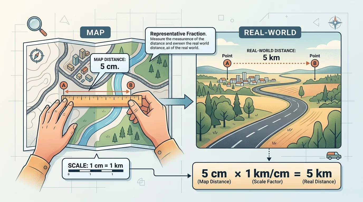
Map scale allows us to represent massive real-world distances accurately on a small piece of paper.
What maps are, the types of maps, and how scale, directions and symbols let a map show a big area.
Preview · progress not saved — Chapter 1 is free
How a map fits a whole city in your pocket.
Imagine visiting a massive city for the first time. How do you fit an entire city, or an entire country, onto a small piece of paper? The secret lies in simple representations and ratios!
How map scale turns small distances into real ones.
Map scale allows us to represent massive real-world distances accurately on a small piece of paper.
Atlases, physical, political and thematic maps, and scale.
An atlas is simply a book or a collection of maps. Maps can be of different kinds depending on what specific details they need to show.
Check what you know about map types and scale.
A map is a representation or drawing of an area, and a book containing a collection of maps is called an . There are several kinds of maps for different purposes. For instance, a map which mainly shows natural features such as mountains, oceans, and rivers is known as a map. To fit a large real-world area onto a small piece of paper, maps use a specific ratio. The component that tells us how much a map has been shrunk down from reality is called the . For example, 1 cm on the map might represent 500 m on the ground.
Directions and map symbols.
To read a map effectively, you need to understand two more essential components alongside scale: direction and symbols.
A compass rose and some standard map symbols.
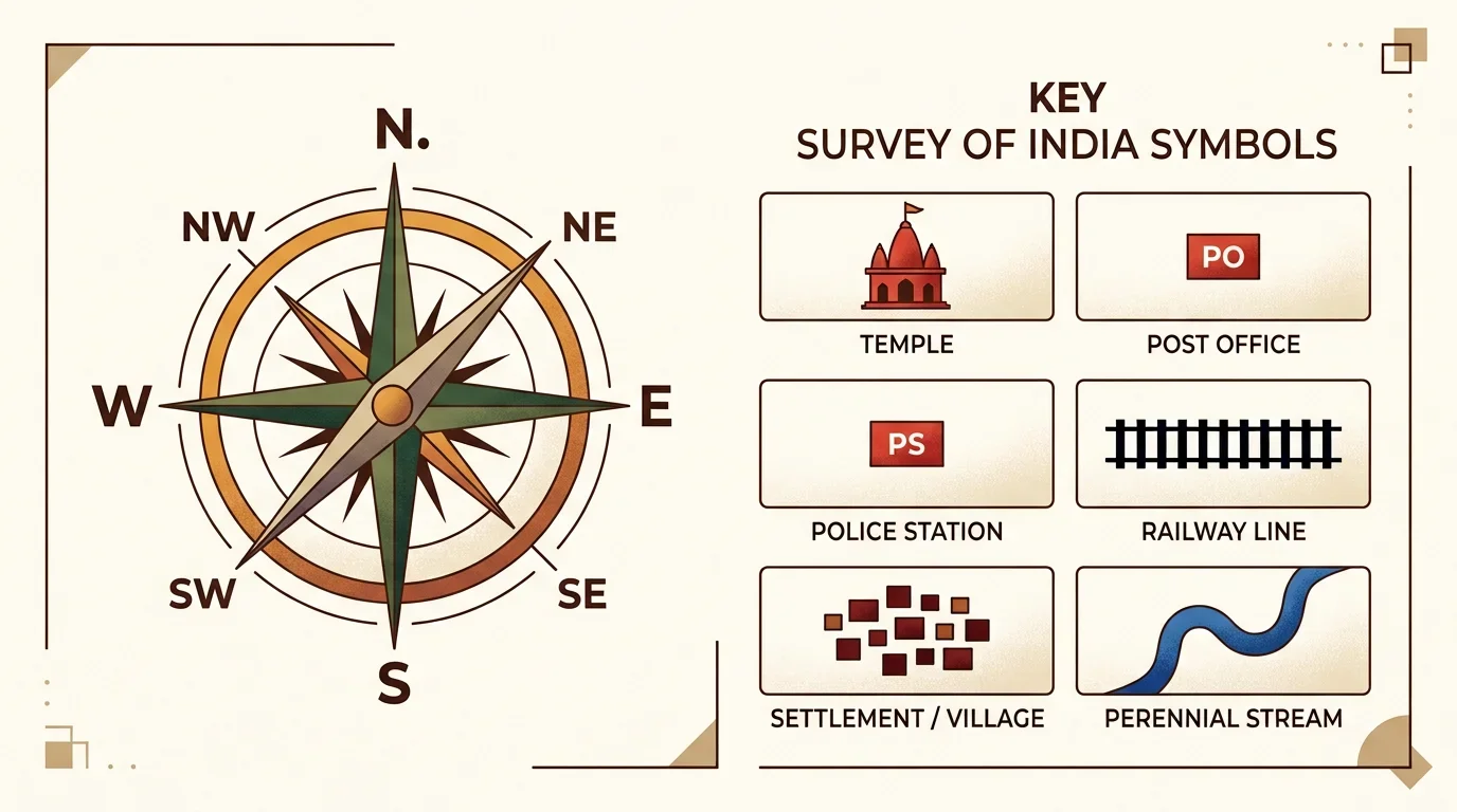
Standard symbols and a compass rose help everyone read a map uniformly.
Cards for the new map words.