The Ujjayinī Prime Meridian
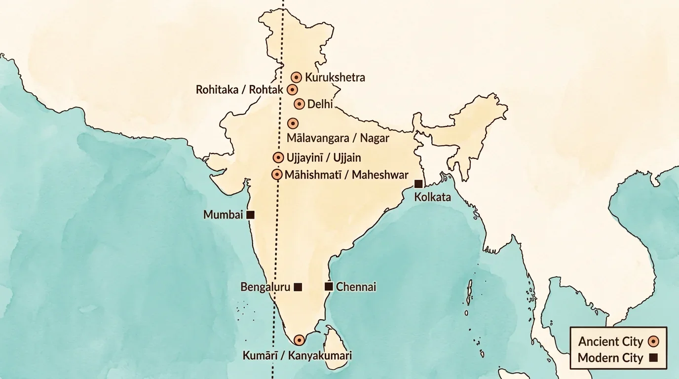
The ancient Ujjayinī meridian, running through India.
Click to zoom
Centuries ago, Indian astronomers used a 'middle line' running through Ujjayinī to calculate global coordinates.
Lines of longitude, the prime meridians of Greenwich and ancient Ujjayinī, and how the grid locates any place.
Preview · progress not saved — Chapter 1 is free
India had its own prime meridian long before Greenwich.
The Greenwich Meridian isn't the first prime meridian! Centuries before Europe set the standard, Indian astronomers used a 'middle line' (madhya rekhā) passing through the ancient city of Ujjayinī (today's Ujjain) as their zero reference point!
The ancient Ujjayinī meridian, running through India.
Centuries ago, Indian astronomers used a 'middle line' running through Ujjayinī to calculate global coordinates.
Lines of longitude, meridians and the prime meridian.
Imagine traveling from the North Pole to the South Pole by the shortest possible line. These half-circle lines are called meridians of longitude. Unlike parallels of latitude, all meridians are exactly the same length.
Check the key facts about longitude.
Lines of longitude are half-circles that run from pole to pole and are also called . To measure them, the internationally accepted 0° line passes through in London. However, in ancient Indian astronomy, the reference prime meridian passed through the city of . Whether you travel east or west from the prime meridian, the 180° East and 180° West lines meet to form the line on the back of the globe.
How latitude and longitude together give a place its address.
When you put parallels of latitude (running east-west) and meridians of longitude (running north-south) together on a globe, they intersect to form a grid.
Earth's grid works like a chessboard.
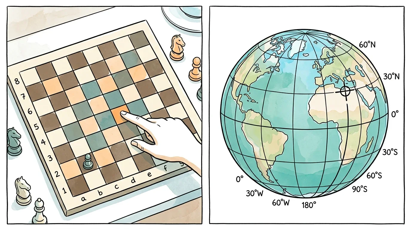
Just like a chess piece relies on a row and a column, earthly locations rely on intersecting latitude and longitude lines.
Work out a place from its coordinates.
To locate a place accurately on Earth, you need both its latitude and its _____.
3 attempts remaining