Parallels of Latitude
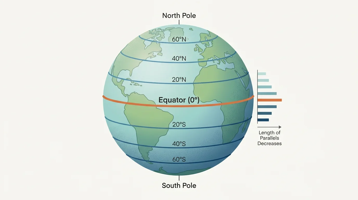
The Equator and the parallels, shrinking toward the poles.
Click to zoom
The Equator is the largest parallel. The circles grow progressively smaller as they approach the poles.
Lines of latitude, and how distance from the Equator decides the climate.
Preview · progress not saved — Chapter 1 is free
Lines of latitude, like rings that shrink toward the poles.
Imagine slicing an onion or an orange horizontally! The slice right in the middle is the largest. As you keep slicing towards the top and bottom, the circles get smaller and smaller. This is exactly how the Earth's grid system works for latitudes!
The Equator, the poles and the parallels of latitude.
A globe is a model of the Earth. Because our planet is nearly spherical (slightly flattened at the poles), a globe represents it perfectly. Halfway between the North Pole and the South Pole is a fixed reference circle called the Equator.
The Equator and the parallels, shrinking toward the poles.
The Equator is the largest parallel. The circles grow progressively smaller as they approach the poles.
Check the key facts about latitude.
To map the Earth, we use a system of imaginary coordinates. The imaginary lines running horizontally across the globe are called of latitude. The largest of these circles is the , which represents 0° latitude. As you move northward or southward, these circles gradually grow smaller. They eventually shrink to fixed points at the very top and bottom of the globe. For example, the South Pole is located at the absolute bottom and is marked as .
Torrid, temperate and frigid zones, and why they differ.
There is a direct connection between your latitude and the climate you experience. Around the Equator, the climate is generally hot. This central band of the Earth is known as the 'torrid' zone.
Earth's three climate zones.
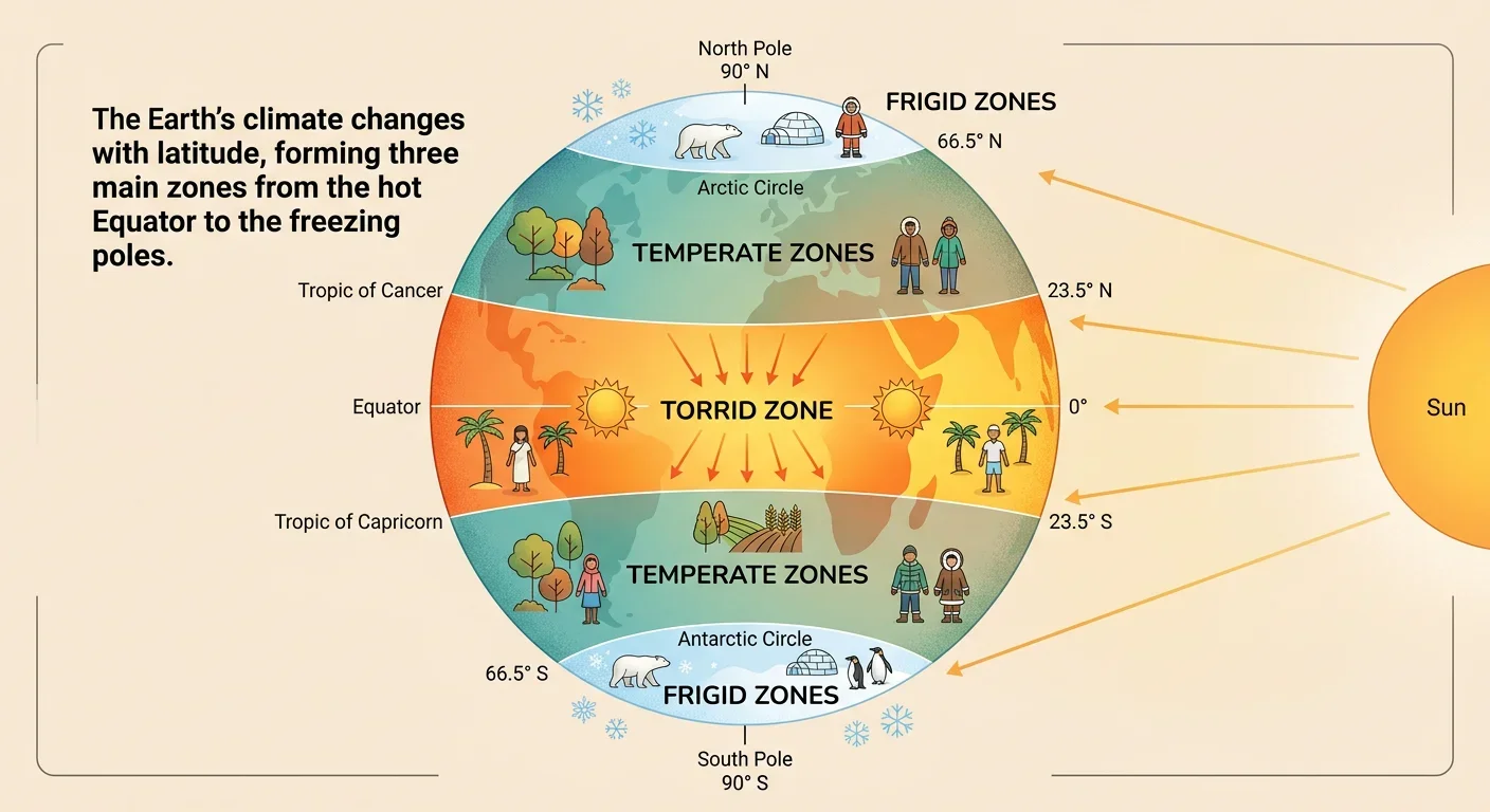
The Earth's climate changes with latitude, forming three main zones from the hot Equator to the freezing poles.
Match each climate to its zone.
Terms
Definitions